Welcome to Landsat Memory Games |
|||
 Info |
 Info |
 Info |
 Info |
|
Game with 14 Pairs of Images (High School Level) | |||
|
Game with 12 Pairs of Images (High School Level) | |||
|
Game with 10 Pairs of Images (High School Level) | |||
|
Game with 8 Pairs of Images (Middle School Level) | |||
|
Game with 6 Pairs of Images (Middle School Level) | |||
|
Game with 4 Pairs of Images (Elementary School Level) | |||
Game Instructions
Remote Sensing Memory is an online version of memory, a card game designed for one or more people. Image file cards are laid out in a grid face down with the earth logo on top.
On a shared screen, take turns flipping pairs of cards over. On each turn, the player will first turn one card over by clicking onto the earth logo, then a second by doing the same. If the two cards match, the player scores one point, the two cards stay image side turned up on the game board and the player continuous. If the images do not match, the cards are turned back over and it is the other player's turn.
In a solo game, or if each player has their own screen, the objective is to match all pairs in the shortest amount of time. The player with the shortest amount of time needed after all the cards have been matched wins. When cards are turned over, the challenge is to remember where they are located for when the matching card is turned up later in the game.
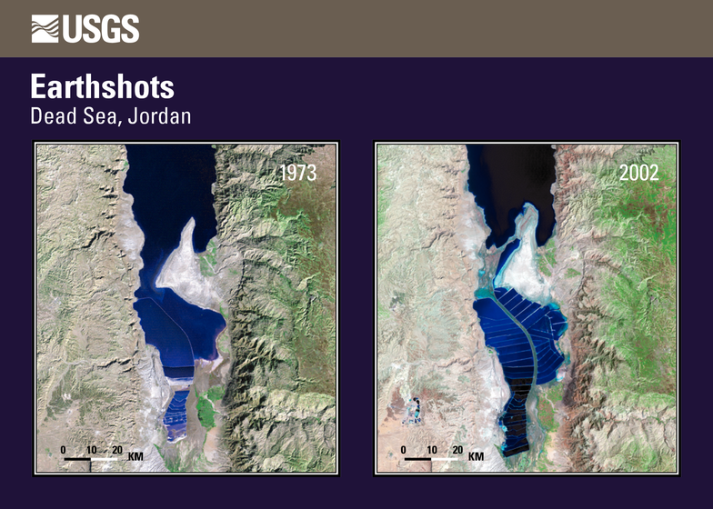
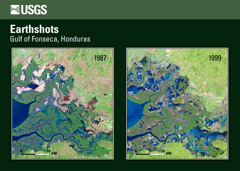
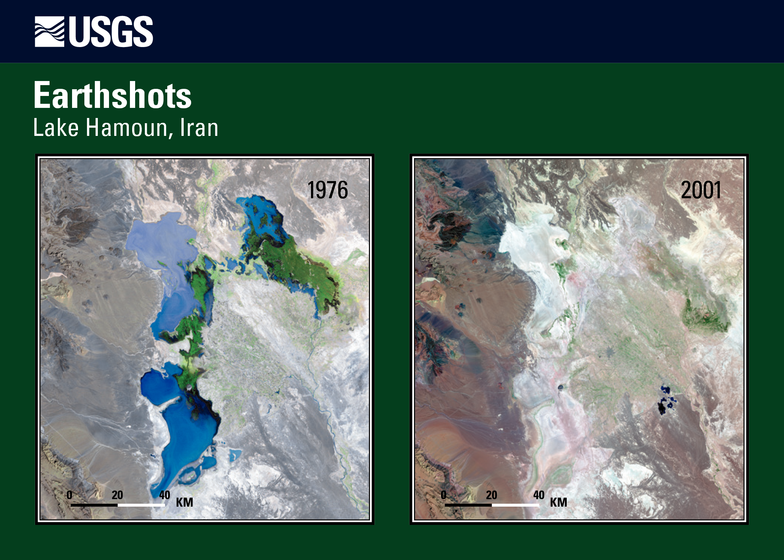
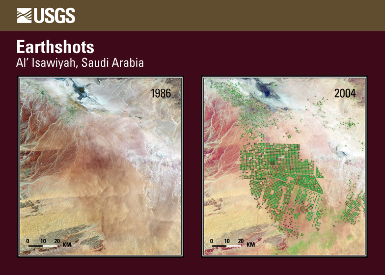
At the end of the game, click on the images to find out which part of the earth they are from. Click again on the image to collect some more information. This game contains the EarthShot imagery series of the United States Geological Survey (USGS).